By Howard Deevers
You might be thinking about aerobatic flying, but no, this “flying on the edge” means flying the edge of the State of Arizona, something that I have been thinking about doing for several years. I wanted to fly the complete border of the State. The trip would start in Nogales, then fly along the border between Mexico and Arizona to Yuma, then follow the Colorado River north, then the border east bound to the Four Corners, and then south and end up back in Nogales.
Sounds simple enough, right? There are a few things to consider before making such a trip. On the Arizona side of the border of Mexico is the Goldwater Range, Restricted Areas R2301W and R2301E. If the military is doing training in those areas, you cannot fly through or along the border. High altitude is a consideration in the east between Arizona and New Mexico. In the heat of the summer, the high-density altitude might be a problem as well. Like any cross-country trip, weather is always a factor.
My big break came on Thanksgiving weekend. With the weather cool, clear, and most other factors cleared, I talked to my friend, Alexander, and we agreed that Sunday and Monday, November 29-30, 2020, would be our best shot at this for the year. Early Sunday morning we departed from our base in Marana and made the short flight to Nogales. After departing Nogales, I contacted Albuquerque Center to see if the Restricted areas were open. Yes, we could fly the border from Nogales to Yuma. I had anticipated this since it is a 4 day weekend for many, including the military. Even Yuma Tower was closed, but the approach control was still on duty.
After departing Nogales, there is some higher terrain to cross, then the desert goes downhill all the way to Yuma, which is only 213 feet MSL. There are some Wildlife refuge areas that require that you fly at least 2000 feet above those areas. We flew this part at about 7000 feet so that ATC could still see us on radar, too. The border is marked most of the way by a wall, but there are some areas that you can't really tell the US from Mexico at that altitude. The desert is awesome to see all the way across.
After a short break in Yuma, we topped off the gas and headed north following the Colorado River. This part we flew at 2500 to 3000 feet AGL. The river has many twists and turns, and both sides of the river have many farms and the area is green, where the desert was brown. We did a touch and go at Parker (P20), then continued to Lake Havasu City (HII), and did another touch and go there. Before the airport we got some pictures of the London Bridge that provides quite a lot of history for that area. After our touch and go, we continued to follow the river to the Laughlin Bullhead airport (KIFP) and stopped for fuel and rest.
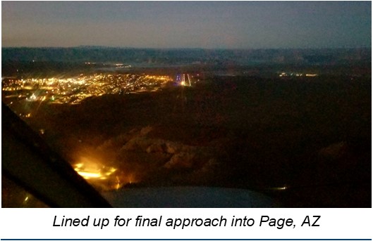
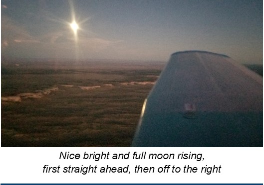
Now it is was mid-afternoon, and our final goal for the day was Page, AZ. In order to make Page, we cut off the northwest corner of the state, since we had traveled that part already on other trips, and headed eastward south of the Grand Canyon and around the Special Flight Rules area into Page. We got to see the full moon coming up in the east and landed there just before 6 PM. Watching the moon rise was the “icing on the cake” for the trip.
The objective of this trip was not to fly it as fast as possible, but to fly it as low as practical, so we could experience as much of the terrain and see as many ground features as possible. Some of the areas that we flew over could only be experienced from the air as there are no roads into those backcountry areas.
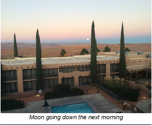
The airport services were already closed in Page (KPGA), and it was cold and dark except for the bright moon light. We got a cab to our hotel for the night and ordered a pizza to be delivered. The next morning, we were able to watch the full moon setting in the west.
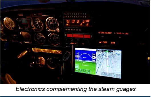
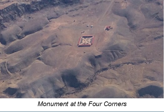
It was cold in Page. We got to the airport at 8 AM when things opened. Full fuel and ready we were off at 9 AM and headed east along the Arizona/Utah border. This time there was no marking to show where one state became another. The only way we knew were we were was from the iPads with ForeFlight. Everything in this part of the state is at high elevation. Page is 4317 feet MSL and only 27 miles to the east is Navajo Mountain at 10,346 feet. We passed through Monument Valley where there are many features at 5 to 6 thousand feet. In about one hour and ten minutes we were over the four corners where a monument is placed to mark the boundary of Arizona, New Mexico, Colorado, and Utah. We circled the monument twice, flying through 4 different States in less than 4 minutes.
Now it was time to head south. There is much more high terrain, and we were climbing to 10,500 feet to clear the tops of some of these mountains. Many still had snow on them from the storm that passed this area just over a week before. The further south we went, the more population we saw, and that was not much. Our next stop was Springerville, AZ (KJTC). There are not as many places to land on the east border of the state, or as many other services, such as places to stay, as on the west border.
On the west border of the state there are many more large communities with motels and services: Yuma, Lake Havasu City, Bullhead City, and further north is the Las Vegas area with more motels than you can count. On the northern border there is Kanab (KNB) that is actually in Utah, but right on the border, and then Page. Other than those, your next stop will be Springerville, and no place from there to Douglas on the southern border which has motels. Then Bisbee and Nogales will have shelter, if you can get to it. Sierra Vista has many motels, but that airport is not right on the border.
I am sure that I’m not the first pilot to ever do this circuit around Arizona, and I won't be the last. The education and freedom of flying made all of this possible, and seeing the diversity of this wonderful State was worth the trip. If you go, plan carefully, and take emergency supplies with you. If you are forced to land remotely due to weather or mechanical issues, you might be there for a while. With the communications and ADS-B systems we have today, it seems likely that help would be on the way quickly, but don't count on that alone. Be prepared.
For tips on planning and being prepared come to an ARIZONA PILOTS ASSOCIATION, safety seminar. Look for one in your area. Sponsored by the FAA Safety Team, these are free seminars, and they do count for the WINGS program.
