- Details
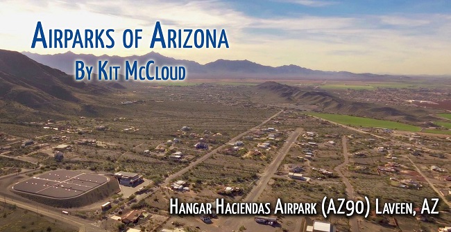
 Hangar Haciendas Airpark (AZ90) Laveen, AZ by Kit McCloud. This airpark has to catch your eye if you’ve flown over it or driven by it. Nestled between South Mountain of Phoenix and a small ridge to the north, Hangar Haciendas Airpark is slightly out in the country you might say, but at the same time close to the metropolitan Phoenix area. As you can see in the
Read more: Hangar Haciendas Airpark (AZ90) Laveen, AZ
- Details
 Castle Well Airpark (0AZ5) Morristown, AZ. Steve and Jackie Andros, originally from Cave Creek, searched out an area years ago near Morristown to build a runway and settle down. They purchased this 55 acre parcel now divided into smaller parcels for home sites. The micro area where the airpark sits is unique in that it contains beautiful views with an
- Details
 Moreton Airpark (23AZ) Wickenburg, AZ. Moreton is one of the oldest in the family of private Arizona airparks. Originating on the Moreton Ranch, at an elevation of elevation 2455’, the airfield was first surveyed and graded back in the fifties. In 1958 it was recognized by the federal government and designated by the FAA as 23AZ.
The airfield property originally
- Details
 Thunder Ridge Airpark (AZ28) Morristown, AZ. Marristown, as described by Wikipedia, is a census-designated place in Maricopa County. The Thunder Ridge Airpark is located at the intersections of highway 60 and 74 on the way to Wickenburg. The airpark originated by four persons coming from another satellite airport in the Phoenix area back in 1993.
The home
- Details
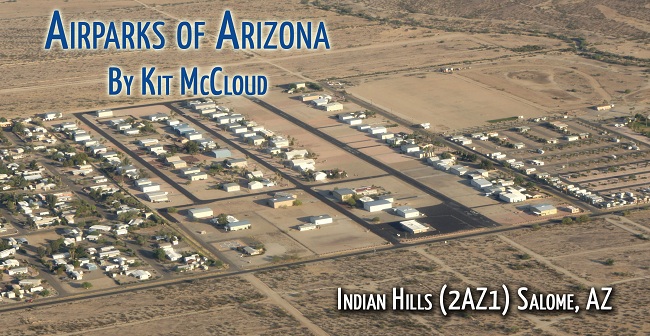
 Indian Hills Airpark (2AZ1) Salome, AZ. Many of the Arizona airparks have uniqueness about them and Indian Hills is no exception. Located 100 miles west of Phoenix Sky Harbor on Highway 60 midway between I-10/60 junction and Aguila (Eagle Roost airpark), this airpark is home to 70 residents on 93 home sites. I had the pleasure of speaking with Jerry Breeyear about the
- Details
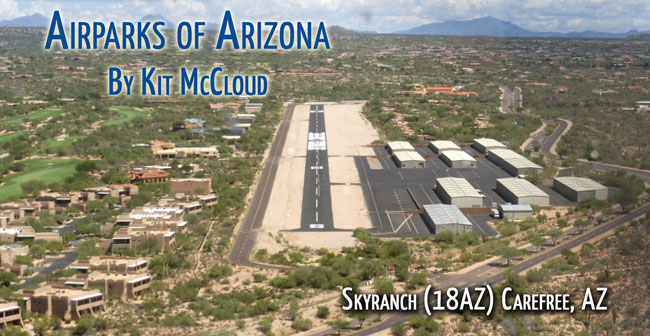
 Skyranch (18AZ) Carefree, AZ. “Caution: Aviation may be hazardous to your wealth…” As promised, I wanted to showcase some of Arizona’s many airparks. Where better to start than the very first Arizona airport to offer residents fly-in access? Carefree’s Skyranch. At an elevation of 2568 feet, the 27 acre airpark is in a magnificent location northeast of Phoenix, near
- Details
 Montezuma (19AZ) Camp Verde, AZ. This airpark is situated 20 miles due south of Sedona and 15 miles southeast of Cottonwood, adjacent to Hwy 17. However, one cannot see this airpark from the highway because it’s on a plateau which provides magnificent views of the surrounding mountains for the airpark residents. Runway elevation and length are both 3300’. The airpark is
- Details
 La Cholla Airpark (57AZ) Oro Valley, AZ. What better place to star gaze than twenty miles northwest of Tucson in Oro Valley, at the base of the dramatic Tortolita Mountains? Here lies the 1,000 acre La Cholla Airpark with an unobscured sky for star gazing. This magnificent location is home to 91 established residences. Though already a private airpark, the ultimate
- Details
 Mogollon Airpark (AZ82) Overgaard, AZ. Many of us have traded the heat of the summer for those cool breezes whispering through the tops of the pines on the Mogollon Rim. At 6,658’, 50 miles east of Payson, 35 miles west of Show Low, surrounded by the Apache-Sitgreaves National Forest and nestled in the world’s largest stand of those Ponderosa pines, lies the magnificent
- Details
 Eagle Roost Airpark (27AZ) Aguila, AZ. Take a glorious flight and go 25 miles west of Wickenburg to the furthest northwest corner of Maricopa County. There you will find Eagle Roost Airpark, (27AZ), in the Valley of the Eagle. At an elevation of 2206 feet, Smith Peak to the northwest and Harquahalla Mountains to the southwest tower majestically in the distance and as a
© 2023 Arizona Pilots Association. All rights reserved.
(602) 456-2898 - PO Box 61242, Phoenix, AZ 85082-1242
