
By Fred Gibbs
Just to be clear, the opinions and statements made within my articles are strictly mine and may not necessarily reflect any policy or position of the Arizona Pilots Association.
With a little help from Mother Nature, my flight from Flagstaff down to Ryan last month (mid-January) only took one hour 10 minutes!
However, getting to the airport here at Flag took me almost a half hour to go 1.2 miles! I was boxed into my driveway by a 2-foot berm courtesy of a late-night snowplow. Pushing, pulling, and digging finally got me through the icy, hard-packed snow berm, but late to the airport. Upon arriving at Wiseman Aviation, where they had very kindly stuck my Super Viking into their warm hangar overnight, no one was there to open the hangar and/or move all the ground equipment out from in front of my airplane. Ironically, the lineman responsible for opening that morning was also blocked in by a snowplow-generated berm! A late start and a great plan gone awry. but Mother Nature came to my rescue, and her tailwind got me to Ryan on time. Maybe she felt sorry for me! The flights down and back were super smooth, with flight visibilities of more than a hundred miles. On the way back to Flagstaff, still south of Williams-Gateway at 10,500 feet, I could clearly see the pure white, snow-covered Mogollon Rim stretching from Sedona to the White Mountains over by Show Low and Mount Humphries behind Flagstaff. It was an absolutely beautiful day to fly.

Fred’s Perspective: Which Way Is Up?
The magnetic pole’s movement is erratic, so why are we still navigating based on magnetic north rather than true north?
By Bob Teter -Published: August 26, 2021 (Re-printed with permission)
Remember when you were a student pilot prepping for cross-country flights with a sectional chart, using your plotter to calculate the true course to the destination? Then using magnetic variation (east is least, west is best) to get magnetic course. GPS navigation and all our apps have changed that, but the basics remain.
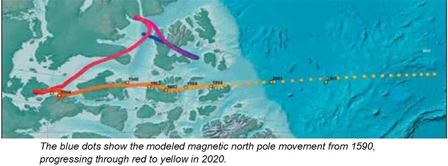
You might have missed how much the magnetic variation is changing. What makes that interesting is that the magnetic poles have recently been moving faster. For most of the period going back to 1832, the movement of the magnetic north pole has drifted along at about 15 kilometers per year. But since the mid-1990s it has accelerated to 55 kilometers per year. Additionally, the magnetic field strength has been decreasing. According to the European Space Agency (ESA), the magnetic field has lost nearly nine per cent of its strength on a global average in the last 200 years. The decrease in field strength in the South Atlantic is even more, causing this area to be labeled the South Atlantic Anomaly.
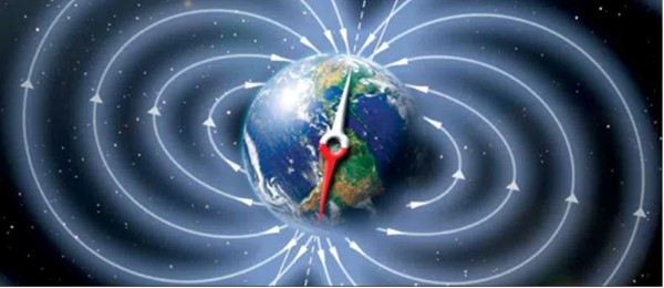
Earth’s Geomagnetic Field:
In its simplest terms, the earth’s geomagnetic field is like an internal bar magnet. However, it is not vertical but is tilted so the magnetic north pole does not align with the earth’s ellipsoid’s north pole, where Santa Claus lives. The change in the tilt of the bar magnet is what causes the magnetic poles to move on the earth’s surface.
Recent studies show that approximately 42,000 years ago the tilt and field strength changed so much that the north and south poles swapped. They stayed that way for several hundred years then swapped back. Because of the lack of the shield provided by the earth’s magnetic field, the charged particle radiation from the sun increased. The humans at the time took to protecting themselves in caves. Much of the cave art came from this period. If you are a survivalist, you might stake out your nearest cave and brush up on your cave art just in case the poles flip again.
The magnetic field at the surface and airborne can be visualized as the iron filings on a sheet of paper suspended above the bar magnet. (Remember doing that in grade school science class?) However, this description is a super simplification.
The true reason for the earth’s magnetic field is much more complicated and spans many fields of study. One reason it is not well understood is it involves so many different areas of expertise from Geology, Astrophysics, Geophysics, Plasma Physics and Electrodynamics. A January 2019 article in Nature magazine was titled “Earth’s magnetic field is acting up and geologists don’t know why. Erratic motion of north magnetic pole forces experts to update model that aids global navigation.”
FMS/GPS Navigation Systems
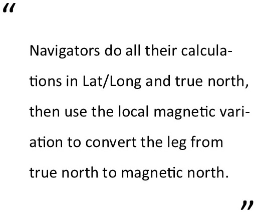
Modern electronic navigators use the earth’s magnetic field in two different ways. The navigators do all their calculations in Lat/Long and true north. Then, just like you did as a student pilot, the navigators use the local magnetic variation to convert the leg from true north to magnetic north. To do this the computer has a “model” or a mathematical grid of the local magnetic variation.
There are different models, but the World Magnetic Model (WMM) produced by the US/UK and NATO is commonly—but not universally—used in aviation. It is distributed by the National Oceanic and Atmospheric Administration (NOAA). It is updated every five years unless, like recently, there has been a larger than expected change. Right after the release of the 2015 WMM there was an unexpected change in 2016 which resulted in an unscheduled update.
Navigation databases also include the magnetic declination for each VOR station in the database. When the VOR station was installed the phasing of the two 30 Hz signals was adjusted so the radials were aligned to magnetic north. The amount of phase shift (the difference between magnetic north and true north) at the time of VOR alignment is recorded as the station’s declination. As time moves on, the local magnetic variation can change, but the station alignment will not be readjusted until it exceeds five degrees (Before 2017 it was three degrees and Canada still uses two degrees as their criteria). In 2016 there were 568 U.S. VORs that exceeded three degrees and 172 VORs that exceeded five degrees.
The RNAV systems that provide for Rho/Theta navigation (DME/VOR) use the lat/lon of the VORTAC and the DME distance along the VOR radial to determine the aircraft’s position. However, to accurately determine that position, the FMS also needs to know the station’s declination from the navigation database. Using the WMM as the station’s magnetic declination instead of the actual alignment declination leads to position errors. If the difference between the WMM’s magnetic variation and a station’s declination was three degrees, this would result in an FMS Rho/Theta position error of over three miles when 60 miles from the station. This is exactly what happened to one RNAV manufacturer in the 1980s and the FAA didn’t discover it for years.

So What?
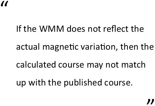
If the WMM does not reflect the actual magnetic variation, then the calculated course may not match up with the published course. There have been advisories from aircraft manufacturers such as Boeing, Service Bulletins from avionics manufactures, and in certain cases Airworthiness Directives on the hazards of out-of-date WMMs. Different avionics manufacturers handle the WMM differently, but unfortunately the WMM is often placed in firmware and is not part of the normal navigation database update. (Garmin uses the International Geomagnetic Reference Field model that they deliver with navigation data.
Quoting from a Universal Avionics August 19, 2011, Service bulletin, “The WMM takes the historic rate of change of the Earth’s magnetic field and linearly extrapolates to the current year. The model is highly accurate during the base year, but accuracy slowly degrades over time … The FMS accepts the WMM as valid for 15 years after the base year … Operational significance varies both by area of flight and leg type. The areas where the greatest Mag/Var errors occur are Europe, Canada, the Northern U.S., and Western South America. Use of legs such as Course-to-Fix (CF) in SID procedures in Europe have produced the most significant errors reported … Operators who are experiencing Mag/Var related problems, especially in SID procedures, should discontinue flying the affected procedures using FMS and utilize other primary means of navigation…” While this was quoted from Universal Avionics, all RNAV/FMS/ GPS/INS navigators have similar issues.
As stated before, the VOR radials are relative to magnetic north. If the variation is too great, then the ground station is supposed to be realigned and rechecked. The realignment itself is simple. However, the work does not stop at the VOR site. The FAA’s Flight Inspection group is required to fly the VOR in all quadrants to assure there are no discrepancies. All approaches based on that station must be re-flown and republished. The station’s new declination is recorded and must be changed in the FMS database that uses Rho/Theta navigation to supplement the GPS. The maintenance expense is one of the reasons the tolerance was increased by the FAA from three to five degrees. Plus, it’s wasteful to realign even one of the hundreds of VORs that are slated for future decommissioning as part of the minimum operational network (MON) program.
So, is there an immediate problem with the 172 VORs that exceed five degrees? No, as long as the FMS uses the stored declination for the station, the resulting Lat/Long aircraft or waypoint position will be correct. A pilot flying the “raw signal” to or from the VOR would normally assume the crab angle is due to the wind or other inaccuracies. There is no immediate issue, but letting it get beyond five degrees is not good practice and can lead to other problems. Not immediately realigning the VORs saves on the FAA’s maintenance budget and the pilot’s navigation database costs.
Also, remember the runways are numbered relative to the magnetic heading. They will have to be renumbered if the variation gets too great. Then all the approach information and airport diagrams must be updated. Both printed and electronic representations are affected. The increase in the rate of change in the magnetic variation will add expenses to the aviation community.

True North Navigation
Why not make everything relative to true north rather than magnetic north? You would not have to worry about the changing magnetic variation. In the future this is possible. Today’s air carrier aircraft and heavy iron business jets have inertial navigators that do not have a flux valve/magnetic field sensor input. All the calculations are relative to true north. The final step is to use an earth’s magnetic field model to convert it to magnetic north.
On the air carrier aircraft, the heading on the Primary Flight Display and Navigation Display can be switched to true instead of magnetic north, eliminating the requirement for the magnetic model. Today this feature is only used when flying polar routes.
As you take a step down to an aircraft with an attitude and heading reference system (AHRS) or a slaved directional gyro, a flux sensor is an integral part of the system. That device senses the earth’s magnetic field and electrically “points” to magnetic north. Besides using it as the magnetic heading, the AHRS uses the flux valve input to assist in calculating the attitude of the aircraft.
In light aircraft, it’s the whiskey compass that aligns to magnetic north. Of course, any slaved compass system (including AHRS) also is aligned to magnetic north. Once your primary data is relative to magnetic north then all supplemental navigation data must be based on magnetic north. Said another way, if the heading is magnetic then all the navigation overlay data must also be based on the magnetic heading.
Additionally, all aircraft must have the same baseline; that today is magnetic headings. You cannot very well have the airlines flying true headings and the rest of us flying magnetic headings. In the future the highly accurate gyros and accelerometers used in inertial navigators might come down in price where their use can become widespread. However, you’ll still have a huge legacy fleet that would have to be retrofitted.
So “in the future” is probably a long way off. Having said that, it is being discussed by IACO and IATA and it is a part of Nav Canada’s “Vision to 2030.” Nav Canada, the owner and operator of Canada’s civil air navigation system, is soliciting support for the change. They already have a northern area where all navaid and runway references are to true north.
Conclusions:

It would be good to check with your avionics manufacturer to see what baseline magnetic model your system is using. If you hear something about changing from magnetic to true north navigation in the future, I hope this article will have provided you some useful background on the topic. And the next time you grumble about the high cost of the navigation database you should consider the ever-increasing instrument flight procedures that are being cranked out. Thankfully, the FAA is actively seeking to decommission seldom used procedures, but that is the topic for another article.
Discussion point: Does It Affect Climate Change?
An interesting sideline to this story is the research, mainly in Europe, into climate change being caused by changes in the Earth’s geomagnetic field. Life on earth is heavily dependent on the earth’s magnetic field shielding us from the sun’s charged-particle radiation. Research is exploring the effects of the changes in both the tilt and strength of the earth’s magnetic field in relation to the climate change we are experiencing. A French geophysicist, Vincent Courtillot, has been a focal point in this investigation. The U.S. appears to be locked in on fossil fuels being the sole reason for climate change. The governmental climate change programs are aimed at reducing the “greenhouse gasses.” Canada seems to be more open to discussion of other causes of climate change. An article in the May 2016 issue of Canadian Geographic—a magazine of The Royal Canadian Geographical Society was titled: “Is Climate Change Linked to Geomagnetism? —Crackpot theory or viable explanation?” It is a good summary with numerous links to other articles, both pro and con. —BT
SAFETY PROGRAMS

Sorry to report that there are no APA FAASTeam safety programs currently scheduled for the next 2 months as of right now. However, more programs are planned over the next couple of months around the state. Simply log on to the Internet and go to WWW.FAASAFETY.GOV, click on “Seminars” and start checking for any other upcoming seminars. Masks are optional but are recommended.
Should you desire a particular safety or educational program at your local airport or pilot meeting in the future, such as the BasicMed program, our “Winter Wonderland” snow season special, ”The Aging Pilot”, Radio Phraseology, or my newest one on LIFR approaches, which discusses the how’s, why’s, and pitfalls of shooting an approach all the way down to minimums and missed approaches, simply contact me at This email address is being protected from spambots. You need JavaScript enabled to view it., or call me at 410-206-3753. Arizona Pilots Association provides the safety programs at no charge. We can also help you organize a program of your choice, and we can recommend programs that your pilot community might really like. There are also a lot of great webinars online, each about an hour long, and worth credits towards your WINGS participation. You might find one that is right up your alley or really “tickles yer fancy”!!