

By Fred Gibbs
We are doing really great in the “flying safe” world! Here we are, entering our 8th month with only one fatal accident on record. Here is a copy of the NTSB report on the one and only fatal crash here in Arizona so far this year.
Yes, we still have our share of fender-benders, AKA incidents, but not big-time accidents. That is a good sign we are continuing to operate very safely. But bear in mind, monsoon season is approaching very quickly, and weather will raise its ugly head, so please do not get into an argument with Mother Nature. She wins a lot!!!
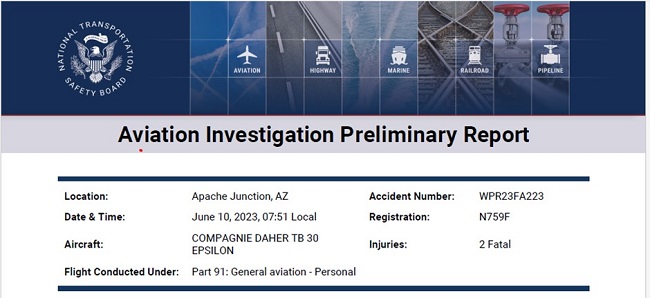
On June 10, 2023, at 0751 mountain standard time, a Compagnie Daher TB-30 Epsilon, N759F, was destroyed when it was involved in an accident near Apache Junction, Arizona. The pilot and passenger were fatally injured. The airplane was operated as a Title 14 Code of Federal Regulations Part 91 personal flight.

The accident airplane was flying formation in the no. 2 position with two other TB-30 airplanes, N315GC (lead) and N130KL (no. 3). The flight of three airplanes departed Falcon Field Airport (FFZ), Mesa, Arizona at 0742 with a planned destination of Payson, Arizona. According to the lead pilot, they intended to fly around the Superstition Mountains east of Mesa, prior to flying to Payson.
Several witnesses observed the airplanes flying to the south along the west side of the mountains at a low altitude. They reported that the lead and no. 2 airplanes were close together, flying similar profiles, while the no. 3 airplane was further behind. One witness stated that the lead airplane crossed a ridgeline in over a 90° bank, and that the second airplane was less aggressive than the first, and the third airplane was higher and even less aggressive. No witnesses on the ground reported observing the accident. The pilot of the no. 3 airplane reported that just prior to the accident, he observed the no. 2 airplane at his 11 o’clock position headed towards terrain, and that the nose of the airplane pitched up and down several times, but the trajectory of the airplane did not appear to change. He said the pilot of the no. 2 airplane did not make any radio calls or report any problems prior to the accident. He reported the accident to the pilot of the lead airplane, and they returned to FFZ.
Recorded Automatic Dependent Surveillance - Broadcast (ADS-B) data was captured for the lead and no. 3 airplanes. The data showed that the flight proceeded eastbound until about 0748, when the flight began maneuvering to the northeast, and turned right to southeasterly heading, towards the Superstition Mountains.

Figure 1 –Lead airplane’s flight path (Satellite View). Arrows depict the direction of flight.
The accident site was not accessible by investigators due to rugged terrain. An aerial assessment of the accident site by a National Transportation Safety Board investigator the day of the accident revealed that the airplane impacted near vertical terrain about 200-400 ft below a ridgeline. The debris field extended about 200 ft downslope from the initial point of impact.
FOR INFORMATION ON ALL ACCIDENTS/INCIDENTS THAT OCCURRED LAST MONTH, REFER TO JIM TIMM’S ACCIDENT SUMMARY HEREIN.